
Tag: offline maps

  • Smart Travel Wearables: Smartwatches, Rings, Earbuds, and Glasses Compared

    Smart Travel Wearables: Smartwatches, Rings, Earbuds, and Glasses Compared

    Travel wearables have evolved into compact tools that can handle navigation, fitness tracking, payments, and safety alerts. But not every wearable makes sense on the road. The best choice depends on your itinerary, battery needs, connectivity options, and the features you will actually use.

    Smartwatches: The Most Versatile Travel Companion

    Smartwatches can replace several small gadgets in your travel bag. They put maps, notifications, payments, fitness tracking, and safety tools on your wrist. GPS is especially helpful during city walks and outdoor trips, and offline maps can keep you oriented when mobile coverage disappears. Cellular models offer even more independence from your smartphone, though coverage depends on regional network compatibility.

    Battery life is the trade-off. A watch that needs daily charging can become a hassle on long trips, while outdoor-focused models often run much longer. Before traveling internationally, check cellular and eSIM compatibility, as support varies by country.

    Smart Rings: Low-Profile Health and Sleep Tracking

    Smart rings take up almost no luggage space and offer a quieter alternative to smartwatches. Their main strength is health tracking, including sleep, heart rate, and recovery, which can be valuable when flights and time zone changes disrupt your routine.

    They also avoid the constant notifications of a smartwatch, making them a good fit for travelers who want fewer distractions. However, most smart rings lack built-in GPS and large displays, so they work best alongside a smartphone rather than replacing one.

    Smart Glasses and Earbuds: Niche Uses, Real Benefits

    Smart glasses remain a niche travel accessory. Features like navigation overlays, cameras, voice controls, and translation can be interesting, but privacy, battery life, and regional availability are practical barriers. They make sense only when the model and destination align with your needs.

    Translation earbuds can be more immediately useful. They help with conversations in unfamiliar languages, and they double as earbuds for music, calls, and noise cancellation on flights. Avoid unnecessary duplication: if your phone already handles translation well, a separate device may not add enough value.

    GPS, Offline Maps, and Safety Features Matter

    Travel wearables become more valuable when connectivity is unreliable. Offline maps provide directions without mobile data, and GPS helps hikers and explorers in unfamiliar areas. Safety features also deserve attention: some premium watches offer emergency communication and location sharing, while rugged models handle water, dust, and tough outdoor conditions. For remote adventures, a durable device with dependable navigation beats a flashy but fragile one.

    Battery Life Can Make or Break a Trip

    Battery performance is easy to overlook before departure but becomes critical after multiple flights and hotel changes. Longer battery life means fewer charging interruptions. Outdoor watches can last weeks on a single charge, while premium smartwatches offer richer features but shorter endurance. Smart rings often last several days, making them convenient for overnight health tracking. Whichever device you choose, pack the right charging cable and verify compatibility before you leave.

    Which Wearables Should Make Your Travel Kit?

    There is no single wearable for every traveler. Consider your itinerary first:

    • Smartwatch: best for navigation, payments, notifications, fitness tracking, and active trips.
    • Smart ring: best for sleep, heart-rate, and recovery tracking without screen distractions.
    • Earbuds: useful for flights, music, calls, and language support.
    • Smart glasses: only worth bringing if the model and destination meet your specific needs.

    City travelers may prioritize payments and navigation. Hikers may prioritize GPS, durability, and battery life. Frequent flyers may prefer sleep tracking and noise cancellation. The best travel wearable is the one you will actually use. If a gadget solves no real problem, leave it at home.

    Frequently Asked Questions

    Which wearable is most useful for travel?

    A smartwatch is typically the most versatile travel wearable. It can provide navigation, notifications, fitness tracking, payments, and safety features. Cellular models add independence from a smartphone, depending on network and regional compatibility.

    Are smartwatches useful for international travel?

    Yes, but check connectivity before you leave. Cellular watches depend on supported networks and eSIM availability. GPS and offline maps can still work without mobile coverage in many areas.

    Are smart rings worth carrying while traveling?

    Smart rings are useful if you care about sleep, heart rate, and recovery. They take up minimal luggage space, but they generally lack displays and built-in GPS, so they work best with a smartphone.

    Can a smartwatch replace a smartphone during travel?

    Most travelers will still need a smartphone. Certain smartwatches can handle calls, messages, navigation, payments, and other tasks independently, but the available functions depend on the device and network.

    Are smart glasses useful for travelers?

    Smart glasses can offer voice controls, cameras, navigation, and translation, but their usefulness depends on the model and destination. Consider battery life, privacy, regional availability, and whether your existing devices already provide these features.
  • Top Hiking Navigation Apps of 2026: Safer Trails with AllTrails, Gaia GPS, Komoot & More

    Top Hiking Navigation Apps of 2026: Safer Trails with AllTrails, Gaia GPS, Komoot & More

    Planning a hike in 2026? The best hiking navigation apps now offer more than just maps — they provide real-time GPS tracking, offline access, and critical trail details that can keep you safe and on track. Whether you’re a day hiker or a thru-hiker, the right app makes all the difference. Here’s our guide to the top navigation tools for exploring the outdoors this year.

    AllTrails – Best for Trail Discovery

    AllTrails remains the go-to app for popular day hikes and well-trafficked paths. It features a massive database of trail maps, user reviews, photos, and GPS tracking. Upgrading to the paid version unlocks offline maps, making it a solid choice for casual adventurers who want to explore new routes with confidence.

    Komoot – Best for Route Planning

    Komoot excels for walking, hiking, and cycling trips. Its turn-by-turn voice guidance, elevation profiles, and offline maps help you plan detailed routes. Whether you’re heading out for a few hours or a multi-day trek, Komoot’s smart routing adapts to your preferred activity.

    Gaia GPS – Best for Backcountry Hiking

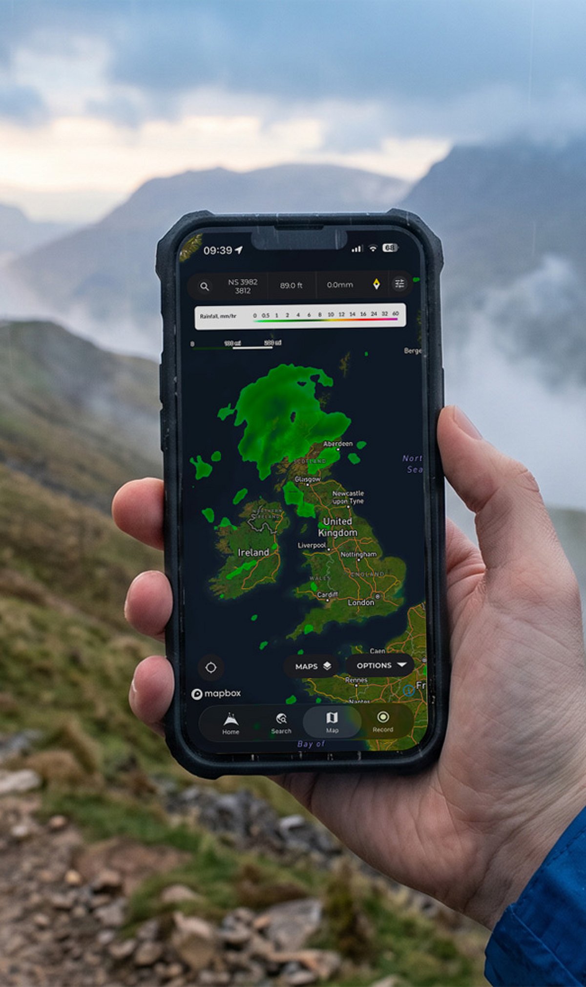
    For serious outdoor navigation, Gaia GPS delivers topographic and satellite maps, offline support, waypoints, and multiple map layers. It’s designed for remote areas where reliable cellular signals are scarce, making it a favorite among backcountry explorers and wilderness trekkers.

    FarOut – Best for Thru-Hikes

    Formerly known as Guthook, FarOut is tailored for long-distance trails like the Appalachian Trail and Pacific Crest Trail. Its detailed guides highlight water sources, campsites, resupply points, and other essential waypoints, giving thru-hikers everything they need to plan and execute extended journeys.

    onX Backcountry – Best for Understanding Land Boundaries

    onX Backcountry combines offline mapping with public and private land boundaries. This is invaluable when planning remote trips where land ownership can be confusing. Hikers can avoid trespassing and find legal access points with confidence.

    CalTopo and Avenza Maps – Best for Detailed Maps

    For advanced route planning, CalTopo offers terrain layers, custom map creation, and powerful analysis tools. Avenza Maps allows users to load georeferenced PDF maps for offline navigation. Both are excellent for those who want fine-grained control over their mapping data.

    Essential Safety Tips

    • Download maps before you leave: Mobile signals can disappear on remote trails. Always save offline maps in advance.
    • Carry a power bank: Battery life drains fast in the wild. A portable charger ensures your device stays powered.
    • Bring a physical backup: A paper map and compass remain the most reliable fallback if technology fails.

    How to Choose the Right App for Your Hike

    • Day hikes on popular trails: Use AllTrails for ease and community insights.
    • Guided routes: Go with Komoot for voice navigation and elevation data.
    • Backcountry trips: Gai GPS offers the best topographic coverage and offline reliability.
    • Thru-hikes: FarOut is unmatched for long-distance trail logistics.

    Always double-check trail conditions and official sources before heading out. With the right app and proper preparation, your hikes in 2026 will be safer and more enjoyable.

  • 9 Clever Google Maps Features That Save You Time

    9 Clever Google Maps Features That Save You Time

    Google Maps is more than just a navigation tool—it’s packed with features that can streamline your daily commute, road trips, and errands. Here are nine time-saving tricks you may not be using.

    1. Save Home & Work for One-Tap Directions

    Add your home and work addresses to Google Maps for instant directions and live ETA updates. No more typing the same locations every day—just tap and go.

    2. Beat Traffic with Smart Navigation

    Enable live traffic updates to compare travel times and avoid congestion. Set your departure or arrival time to plan the fastest route before you even start driving.

    3. Download Offline Maps Before You Travel

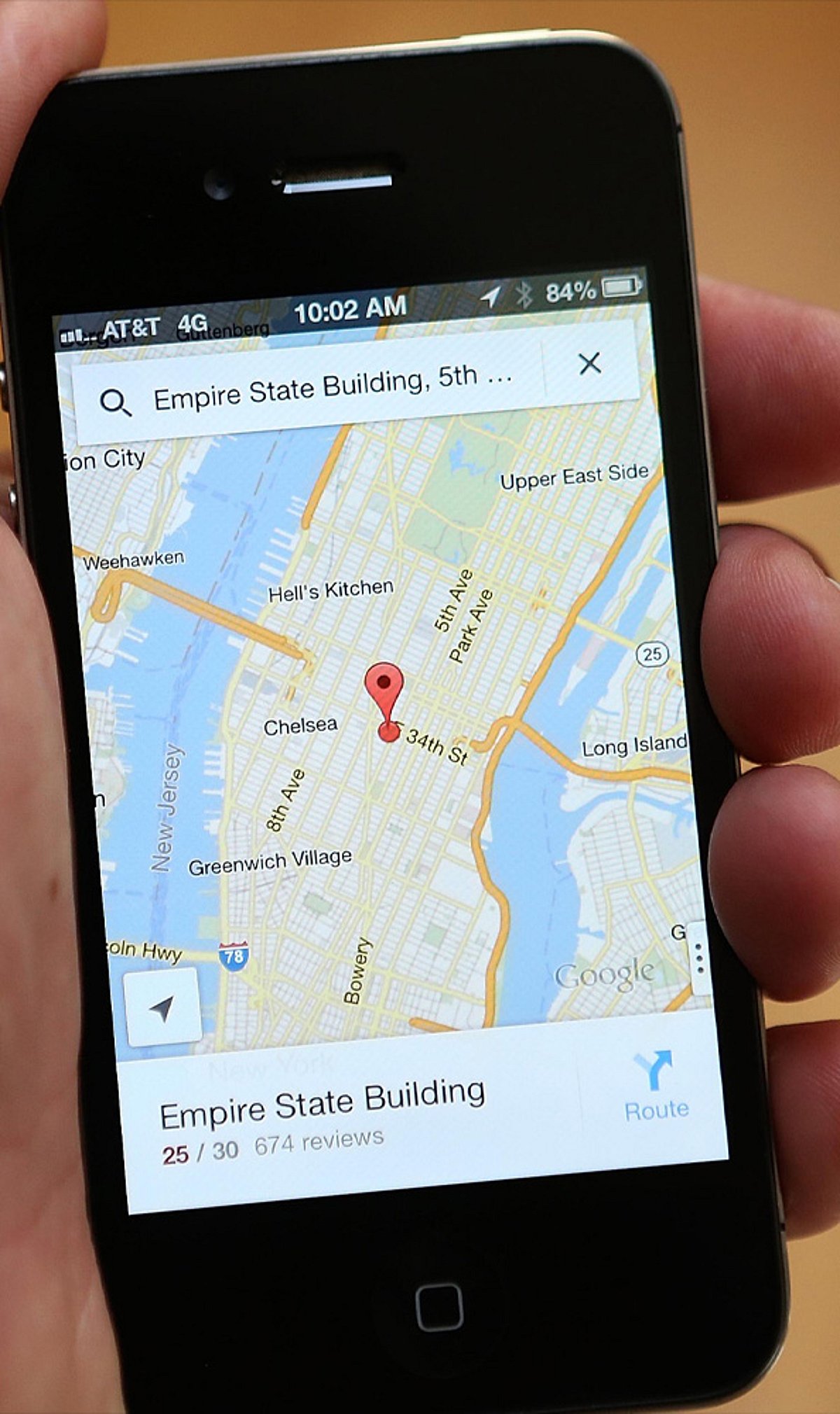
    Save maps for cities or regions in advance. This lets you navigate even without mobile data or in areas with weak network coverage—perfect for travel abroad or remote areas.

    4. Plan Better with Multiple Stops & Parking Saver

    Add up to nine stops on a single route for errands or road trips. After parking, save your location to quickly find your car later—no more wandering around.

    5. Find What You Need Along the Way

    Search your route for petrol pumps, cafés, restaurants, ATMs, or EV chargers without ending navigation. You can also avoid tolls, highways, or ferries to suit your preference.

    6. Use Hidden Features for Faster Travel

    Share your live location with friends, use one-finger zoom to quickly scan the map, explore indoor maps for large buildings, and check popular times at businesses to avoid crowds. These small tricks add up to big time savings.

    Start using these tips today to make your travel smoother and more efficient. For more productivity tips, stay tuned.

  • Cut Mobile Data Costs Abroad: Smart eSIM Tips for Travelers

    Cut Mobile Data Costs Abroad: Smart eSIM Tips for Travelers

    Travel eSIMs have quickly become a mainstream solution for staying connected abroad. According to GSMA Intelligence, 12% of international travelers used an eSIM in the past year, and global eSIM smartphone penetration is expected to keep rising through 2026. The appeal is clear: store multiple operator profiles on one device, switch between them remotely, and skip the hassle of hunting for a physical SIM at the airport. But securing a decent eSIM plan is only half the battle. Real savings come from how you manage data after activation.

    Check Usage Early

    The easiest way to overspend is to treat mobile data like an endless bucket. App refreshes, photo backups, map loading, message sync, and a few reels while waiting for a train can quietly drain your plan. Apple lets you view data usage by app and reset the statistics window, making it easier to spot drains. Android users can leverage built-in Data Saver controls and app-by-app update settings. The first move should always be to see what your phone is actually doing.

    Activate Data Controls Before You Fly

    Many travelers skip this step and wonder why a short trip burns through a full plan. On iPhone, Low Data Mode pauses automatic updates and background tasks on cellular. You can also toggle cellular data on or off for individual apps. On Android, Google’s Data Saver keeps most apps on Wi-Fi for background activity, while the Play Store offers auto-update options like Wi-Fi only or no automatic updates.

    Use Offline Maps

    Navigation is a major data drain. Google Maps supports offline maps on both Android and iPhone. According to Google, an offline map can guide you as long as the full route is within the downloaded area. However, offline transit, bicycling, and walking directions are unavailable on Android, and traffic updates disappear. The smart move: download the parts of the city you need before leaving Wi-Fi, and save live data for unexpected detours.

    Stop Streaming from Eating Your Data

    Videos can quietly blow your travel budget. Netflix offers controls for cellular data use and Wi-Fi-only downloads. The same logic applies to any streaming habit. Use lower-quality streaming, offline content, and manual control instead of letting apps decide for you. The goal is not to avoid entertainment but to prevent it from setting your data bill.

    Restrict Background Activity

    Background data is the sneaky culprit. Every phone has a feature to restrict network use when you’re not actively using an app. Experts warn travelers about auto-updates, cloud sync, and misconfigured backup apps that can wreck a small eSIM plan before lunch.

    Watch Roaming and Wi-Fi Traps

    Data Roaming should be turned off to avoid charges. Apple’s Wi-Fi Assist may switch you to cellular when Wi-Fi is weak, quietly burning through your eSIM. Use your travel eSIM for the data line you want, keep your home line from roaming by default, and ensure your device isn’t jumping onto cellular every time a hotel Wi-Fi login screen gets flaky.

    Use Wi-Fi as a Bulk-Download Window

    Public Wi-Fi should have a specific job: download maps, update apps, save tickets, and pull down content for later. Experts recommend preloading maps and entertainment before travel.

    Why This Approach Beats Buying a Bigger Plan

    The temptation is to solve everything with a larger data pack, but that often leads to lazy spending. A smarter approach: buy the right-sized eSIM, keep background use under control, download offline maps, tame streaming, and avoid accidental roaming. GSMA’s 2026 research highlights that travel eSIMs are becoming mainstream, yet provider differences matter. The cheapest connection isn’t the one with the biggest number on the sales page—it’s the one that matches your actual habits while away.